
The Strait Where Fiber Drowns
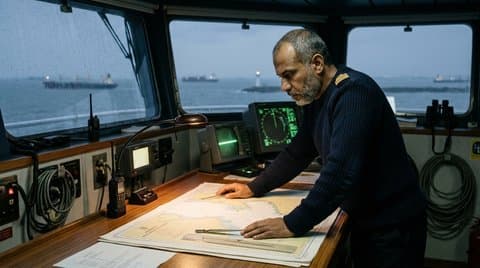
At five o'clock in the morning, thirty nautical miles northwest of Singapore, the Phillips Channel narrows to a navigational throat barely one point three nautical miles wide. From the bridge wing of an ultra-large container vessel drawing sixteen point two meters of salt water, the sea does not look like an open expanse of sovereign territory; it looks like a crowded, illuminated parking lot built atop a subterranean fuse.
Ahead of our bow, forty-eight merchant ships—liquefied natural gas carriers from Qatar, crude tankers riding low from Ras Tanura, and triple-E container ships bound for Rotterdam—maneuver within meters of one another inside the designated Traffic Separation Scheme. Beneath our keel, separated from four hundred thousand tons of steel and bunker fuel by less than nine meters of silt and turbulent current, lie twenty-eight transoceanic submarine fiber-optic cables.
These bundles of high-purity glass, each armored in layers of extruded polyethylene, bitumen, and galvanized steel wire, carry approximately sixty-two percent of all real-time financial messaging, inter-datacenter gradient synchronizations, and sovereign intelligence traffic between East Asia, the Indian subcontinent, and Western Europe.
Our entire planetary civilization operates upon a shared hallucination of ethereal digital independence. We speak of the "cloud" as if computational intelligence floated weightlessly in the stratosphere, untethered from the mess of geography, borders, and salt water. But in the physical universe, the internet is not in the clouds. The internet is resting on the silty seabed of a fourteen-nautical-mile strait in Southeast Asia, subject to the unyielding physics of dredging anchors, tidal surges, and littoral naval sovereignty.
The Dangerous Convergence of Steel and Glass
To understand why the digital economy is geographically fragile, one must examine a nautical bathymetric chart rather than a network topology map. For half a century, the deployment of global telecommunications cables followed a simple rule of economic convenience: the shortest path between two continental economic hubs is the path of least capital expenditure.
When fiber consortia laid the transoceanic backbones connecting Europe and Asia—from SEA-ME-WE-3 to the modern high-fiber-count installations like Asia Direct and 2Africa—they routed them through the exact same ancient maritime chokeholds that Phoenician galleys, Portuguese caravels, and Dutch East India Company merchantmen traversed five hundred years ago.
+---------------------------------------------------------------------------------------------------+
|                           MARITIME CHOKEPOINTS VS. GLOBAL SUBSEA FIBER DENSITY                    |
+--------------------------------+---------------------------------+--------------------------------+
| Strategic Chokepoint           | Average Navigable Water Depth   | Number of Active Subsea Cables |
+--------------------------------+---------------------------------+--------------------------------+
| Strait of Malacca / Singapore  | 25 to 35 meters (High siltation)| 28 Transoceanic Backbones      |
| Bab-el-Mandeb (Red Sea Throat) | 130 to 200 meters               | 16 Intercontinental Systems    |
| Strait of Hormuz               | 40 to 60 meters                 | 9 Regional Critical Trunks     |
| Strait of Gibraltar            | 300 to 900 meters               | 12 Atlantic-Med Systems        |
| Luzon Strait (Taiwan-PH)       | 1,000 to 2,500 meters (Seismic) | 18 Transpacific Backbones      |
+--------------------------------+---------------------------------+--------------------------------+
The consequence of this routing efficiency is a catastrophic physical convergence. In the Strait of Malacca, thousands of commercial ships drop anchor every month, either to await bunkering slots, conduct engine maintenance outside port limits, or survive sudden tropical squalls known as Sumatras.
The Subsea Vulnerability Chain: Shifting Sand Waves → Shallow Water Trenching Limits → 12-Ton Stockless Dragging Anchor → Physical Fiber Shear → Continental Latency Severance
A standard stockless anchor dropped by a modern two-hundred-thousand-ton merchant vessel weighs twelve tons. When that anchor drags across the muddy seabed under the force of a five-knot tidal current, it does not merely scratch the bottom; it digs a furrow two meters deep into the sediment. When that dragging fluke catches an armored submarine telecommunications cable, the high-purity glass strands within do not bend; they shatter instantaneously.
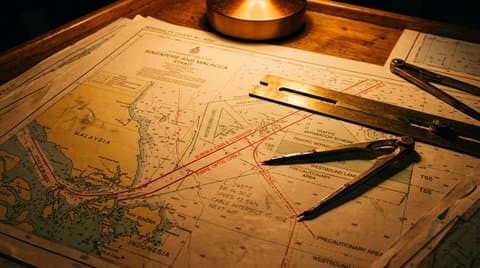 Hydrographic chart of the Malacca Strait with red subsea cable corridors intersecting maritime shipping lanes
The Asymmetry of Repair in Sovereign Waters
When a fiber-optic cable snaps on the abyssal plain of the North Atlantic at three thousand meters depth, the repair is technically difficult but politically frictionless. A specialized dynamic-positioning cable ship steams to the coordinates, lowers a cutting grapnel, recovers the severed ends, splices in a replacement insert, and drops the joint back to the seabed within seven to ten days.
In a shallow, sovereign littoral strait, that same physical repair can take five months.
The reason is not engineering; it is the friction of Westphalian coastal sovereignty. The waters of the Malacca Strait are not high seas; they are divided into the territorial seas, contiguous zones, and Exclusive Economic Zones of three sovereign nations: Indonesia, Malaysia, and Singapore. Under the United Nations Convention on the Law of the Sea (UNCLOS), a foreign cable repair ship cannot simply drop its grapnels into a nation's territorial seabed without formal coastal state authorization.
+---------------------------------------------------------------------------------------------------+
|                        SUBSEA REPAIR TIMELINES: ABYSSAL WATERS VS. LITTORAL STRAITS                |
+------------------------------------+--------------------------------------------------------------+
| Operational Stage                  | Abyssal International Waters   | Sovereign Territorial Strait|
+------------------------------------+--------------------------------------------------------------+
| Cabotage & Coastal Permitting      | 0 Days (Automatic Freedom)     | 45–90 Days (Inter-Ministerial)|
| Security Clearance / Escort Vetting| 0 Days                         | 20–30 Days (Coast Guard / Navy)|
| Marine Traffic Clearance           | Immediate on-station deployment| 10–14 Days (Vessel Traffic Svc)|
| Physical Splicing & Testing        | 3–5 Days                       | 4–7 Days (High Current Windows)|
| Total Mean Time to Repair (MTTR)   | 10 to 14 Days                  | 80 to 140 Days                 |
+------------------------------------+--------------------------------------------------------------+
During those four months of administrative permit delays, data packets must be rerouted across alternate paths—transiting through Pacific trans-polar routes or around the southern tip of Africa via the Cape of Good Hope. For ordinary commercial web browsing, this adds sixty to eighty milliseconds of round-trip latency, an inconvenience that causes video streams to buffer for a few seconds.
For high-frequency algorithmic arbitrage trading, distributed state machine synchronization, and sovereign defense command-and-control networks, that latency spike is an operational catastrophe. It drains liquidity from exchanges, causes distributed database consensus nodes to time out, and forces sovereign state actors to operate on degraded telemetry.
The Shadow War on the Seabed
Because subsea cables are geographically concentrated, unprotected by military garrisons, and clearly marked on every commercial navigation chart to prevent anchoring accidents, they have become the primary theater of gray-zone asymmetric warfare.
A navy wishing to sever a rival nation's financial communications in wartime does not need to launch ballistic missiles at satellite constellations or execute complex zero-day cyber exploits against hardened military intranets. It needs only a converted commercial fishing trawler, an unflagged oceanographic tug, or an unmanned underwater vehicle equipped with a mechanical diamond-tipped circular saw.
The Asymmetric Lever: \$100,000 Modified Commercial Trawler → 500-Kilogram Towed Grapnel → Two Cuts in Territorial Waters → \$40 Billion in Global Financial Disruption
Over the past twenty-four months, naval intelligence agencies across NATO, the Indo-Pacific Quad, and the Middle East have documented an alarming surge in "accidental" anchor-dragging incidents occurring with surgical precision across critical fiber corridors. Commercial vessels flying flags of convenience have repeatedly dragged heavy anchors across seabed cables during periods of regional geopolitical tension, only to claim mechanical engine failure or steering gear malfunction when challenged by coastal maritime authorities.
Under international maritime law, proving that an anchor was dropped with deliberate strategic intent rather than due to ordinary negligence or bad weather is virtually impossible. The offending vessel pays a nominal maritime civil fine of fifty thousand dollars, while the affected continental economies suffer tens of billions of dollars in redirected trade, disrupted financial clearing, and emergency satellite bandwidth leasing.
The Territorialization of the Glass
Faced with this structural vulnerability, the world's major powers have begun to abandon the post-war ideal of a neutral, shared global submarine commons. We are witnessing the rapid territorialization of undersea telecommunications infrastructure.
Sovereign Cable Escort Patrols: Coastal states are deploying specialized littoral combat craft and aerial maritime patrol drones to maintain permanent, continuous surveillance over subsea cable corridors, treating any unauthorized anchoring within two nautical miles of a designated landing zone as a hostile border violation.
Bypassing the Chokepoints at Any Cost: Sovereign infrastructure syndicates are investing tens of billions of dollars into high-risk terrestrial bypass routes: digging armored fiber conduits across the scorching desert sands of the Arabian Peninsula, laying cables through the melting permafrost of the Russian Arctic along the Northern Sea Route, or blasting tunnels through the granite massifs of the Andes.
The Return of Sovereign Redundancy: Governments that once entrusted their diplomatic communications to commercial consortium cables are now constructing classified, single-tenant sovereign optical networks, accepting higher deployment costs in exchange for routes that completely avoid multinational maritime straits.
+---------------------------------------------------------------------------------------------------+
|                            THE NEW GEOPOLITICAL GEOGRAPHY OF TRANSIT                              |
+------------------------------------+--------------------------------------------------------------+
| Traditional Sea Route (Vulnerable) | Emerging Sovereign Overland Bypass                           |
+------------------------------------+--------------------------------------------------------------+
| Red Sea / Suez / Mediterranean     | Gulf-to-Mediterranean Cross-Desert Pipeline Corridor         |
| Strait of Malacca / South China Sea| Kra Isthmus Trans-Peninsular Buried Trench (Thailand)        |
| Transpacific via Luzon Strait      | Trans-Alaska / Arctic Subsea Route (Polar Silk Road)         |
| Baltic Sea Coastal Riser Paths     | Fennoscandian Overland Granite Conduit (Norway-Sweden-Finland)|
+------------------------------------+--------------------------------------------------------------+
The Cold Water Truth
We like to believe that we inhabit an era defined by software, where algorithms, neural weights, and cloud protocols have rendered the physical surface of the Earth irrelevant.
It is a comforting illusion, but it lasts only until you stand on the bridge of a ship in the Strait of Malacca, watching the sonar trace the silhouette of the seabed thirty meters below. Down there in the cold, green water, where the sand waves migrate with the moon and the anchors of twenty thousand ships scrape the mud, the real world remains what it has always been: a precarious, physical place where human civilization hangs by a thread of glass.
If that glass is cut, our algorithms will not save us. Our cloud interfaces will not answer. The screen will turn black, the servers will sit silent in their racks, and we will be reminded of the truth that geography has never ceased to teach: that the mind of our civilization is only as sovereign as the salt water through which it must pass.