
The Red Sea Detour Tax
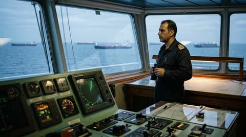
From the port bridge wing of a fourteen-thousand-TEU container ship clearing the southern approach to Ras al-Hadd at first light, the horizon looks deceptively open. On the digital ECDIS chart table beside the radar console, however, the operational geography is narrow, rigid, and deeply contested. For decades, maritime planners treated the twenty-mile-wide Bab-el-Mandeb Strait—joining the Gulf of Aden to the Red Sea and the Suez Canal—as an unassailable conveyor belt linking Asian manufacturing basins to European ports. Every vessel burned low-sulfur bunker fuel along a predictable twelve-day corridor from Singapore to Rotterdam, calibrated to the hour so that automotive plants in Stuttgart and chemical refineries in Antwerp could run with razor-thin buffer inventories.
That geographic assumption is gone. What began as an acute maritime security crisis along the Yemeni littoral has hardened into a structural geographical tax on Eurasian trade. As commercial container lines, liquefied natural gas carriers, and automotive ro-ro fleets continue routing thousands of miles south around the Cape of Good Hope rather than risking asymmetric anti-ship ballistic and drone strikes in the southern Red Sea, the global economy is absorbing a permanent physical surcharge measured in steel hull fatigue, marine fuel tonnage, and lengthened ocean transit days.
The Arithmetic of the Cape Route
When a modern ultra-large container vessel turns starboard away from the Gulf of Aden and sets course south-southwest down the East African coast toward 34°50′S, 20°00′E off Cape Agulhas, the detour is not a minor logistical inconvenience. It adds roughly 3,500 nautical miles to a standard Asia-Europe voyage. Even when shipmasters push main marine diesel engines harder to recover schedule integrity—burning exponentially more fuel per knot due to hydrodynamic hull drag—the round-trip loop stretches from roughly sixty-five days to nearly eighty-five days.
Maritime Dimension | Direct Suez / Bab-el-Mandeb Corridor | Cape of Good Hope Detour |
|---|---|---|
Voyage Distance (Shanghai–Rotterdam) | ~10,500 nautical miles | ~14,000 nautical miles (+33%) |
Transit Duration (One-Way) | 26 to 29 days at 16 knots | 38 to 44 days with weather routing |
Bunker Fuel Burn | Baseline ~1,800 tons VLSFO per leg | +750 to +950 tons additional fuel per leg |
Fleet Capacity Absorption | Standard 10-vessel weekly loop | Requires 12 to 13 vessels for identical weekly frequency |
War Risk & Hull Insurance | Elevated premiums (0.5%–1.0% hull value per transit) | Standard marine P&I coverage with higher Atlantic storm stress |
Notice the silent capacity multiplier in that fourth row: because each ship spends twenty extra days at sea per round trip, maintaining a weekly scheduled sailing between Ningbo and Hamburg physically consumes twenty to twenty-five percent more container ship hulls globally. The ocean itself acts as a floating warehouse, locking millions of metric tons of industrial components, lithium cells, pharmaceuticals, and machine tools inside steel boxes bouncing across South Atlantic swells.
Chokepoints and Floating Steel
Modern supply chain executives spent twenty years worshipping "just-in-time" velocity, convincing corporate boards that inventory sitting in a port warehouse was wasted working capital. That doctrine functioned only because naval hegemonic dominance kept every major maritime strait—Malacca, Hormuz, Bab-el-Mandeb, Suez, and Panama—frictionlessly open at negligible security cost.
The Chokepoint Repricing Cascade: Littoral Chokepoint Contestation → War-Risk Insurance Exclusion → Cape Detour Fuel & Hull Absorption → Port Bunching in Western Europe → Structural Inventory Buffer Expansion
Once a fifteen-mile littoral throat can be interdicted cheaply by shore-launched mobile missile batteries, loitering munitions, and commercial satellite targeting, the economics of maritime insurance invert overnight. Underwriters at Lloyd's do not negotiate with ideological slogans; they calculate hull replacement probabilities.
 Unfolded paper Admiralty nautical charts of the Red Sea and Indian Ocean with brass rulers
And the Cape of Good Hope is no placid canal. Rounding southern Africa in austral winter exposes towering, deeply laden container stacks to thirty-knot crosswinds, steep Agulhas Current counter-swells, and rogue wave crests that routinely snap container lashing rods and topple stacks overboard. Rerouting global trade away from sheltered inland seas and back into the roaring forties extracts a relentless toll in vessel maintenance, dry-docking intervals, and crew exhaustion.
The Sovereign Drift of Industrial Corridors
Look beyond freight rates and you see a deeper geopolitical realignment taking shape across the world's ports and land bridges. When maritime transit between East Asia and Europe permanently acquires an unpredictable ten-to-fifteen-day latency tax—alongside acute drought and draft restrictions intermittently throttling the Panama Canal—geography ceases to be neutral background noise. It becomes the decisive determinant of industrial location.
First, European manufacturers are discovering that long-haul sea supply chains stretching across three oceans are structurally fragile. Component assembly for high-value electronics, grid transformers, and defense hardware is shifting inexorably toward near-shored Mediterranean basins, North African industrial parks, and Eastern European rail-connected hubs that do not depend on uncontested passage past the Horn of Africa.
Second, Gulf states and littoral powers astride these straits have grasped the asymmetric leverage of multimodal land bridges. Rail and pipeline corridors linking Red Sea terminals to Persian Gulf ports, or Mediterranean deepwater hubs to inland European freight yards, are no longer speculative infrastructure sketches; they are sovereign insurance policies against maritime blockade.
"The immaterial economy still floats on saltwater. Every semiconductor wafer, server rack, and copper turbine winding moves inside a twenty-foot steel box governed by sea state, bunker tonnage, and who controls the coastal artillery overlooking a fifteen-mile strait."
Third, port congestion has returned as a chronic structural feature rather than a temporary pandemic anomaly. When dozens of ultra-large vessels arrive bunched together in Rotterdam, Antwerp, or Algeciras after surviving different Atlantic storm fronts around the Cape, crane berths saturate, feeder barges queue for days, and inland rail timetables fracture.
Paying the Permanent Geographic Rent
For fifteen years after 2008, low interest rates and unchallenged naval corridors compressed freight costs so severely that shipping an aluminum extrusion ten thousand miles across two oceans cost less than trucking it three hundred miles overland. That era of frictionless globalization was an anomalous historical interlude, not a permanent law of economics.
Today, every boardroom debating inflation, manufacturing reshoring, or energy security is quietly paying the Red Sea detour tax—whether it appears explicitly as a bunker adjustment factor on a bill of lading, or silently as higher working capital locked in safety stocks across European warehouses. The world is re-learning an ancient lesson of statecraft and trade: sea lanes are never free, geography never sleeps, and when a narrow strait closes, the entire planetary balance sheet must sail the long way around the storm.